Disk Cove to Brave Harbor via Lake Bay Hatchery

We couldn't leave until the tide rose, so we started our day with a great breakfast of pancakes and sausage. It was overcast today, after such a sunny day yesterday…and then it started to rain. It was no issue departing Disk Cove (we never saw below 19’), and we saw a humpback as we passed Passage Point.

Can't go out there at low tide

We’re crossing one of the deepest parts of Print William Sound. I saw 2532 feet as our deepest sounding today.  It was a long day for us, about 30 miles, and it continued to be rainy with low visibility. We had planned to go to Perry Island for the day, but the weather was a bit too icky for much exploring. We saw the Klondike Express both on AIS and as a hazy visual target, and the ever-present ferry Chenega.

Getting very deep

It was lightly raining when we entered Esther Cove to visit Lake Bay Fish Hatchery. Karen read in one of the guidebooks that they gave tours and that there was some great walking, and we were looking for something to do.

The problem with Esther Cove it that is very deep. We could handle the depth with our 400ft of chain, but there are many large moorings in the cove for the fishing fleet to sue. The boats on the moorings drastically restricted the amount of swing room we could have,  such that we never found a place to drop the hook after 45 minutes of exploring every opportunity.

As we were only going to be there a short while to take the tour, I would have gladly tied to one of the moorings ourselves, but every one was in use by the fleet. The next opening was not for another two days, so they were going nowhere.

The cove was full of salmon jumping about. As a result, the trees were full of eagles looking for some easy picking. If only we could have found a place to drop the hook and the rain had stopped, I could have spent hours taking photos of the eagles as they fished the cove.

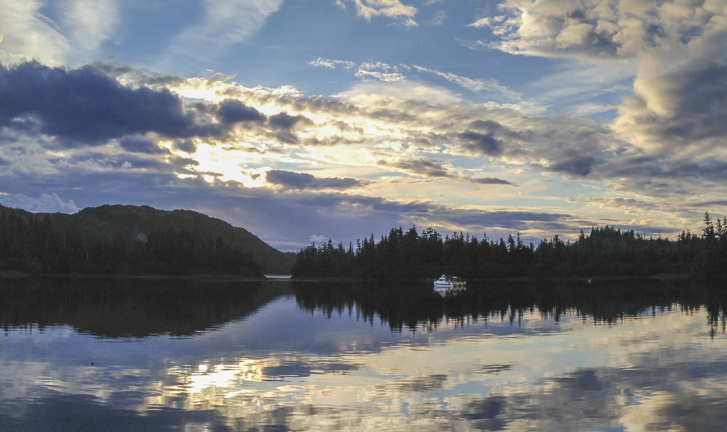
Skunked at the Hatchery, we changed our destination for Brave Harbor in Squaw Bay. There were 2 bowpickers at anchor (Guinness and Nemo) when we arrived. It was a pretty cove, and very calm. There was a heavy downpour as Karen stood at the bow to drop the anchor.

We spent a quiet afternoon reading. The coolest thing we saw was an eagle that caught a salmon, and because the salmon was so heavy, it actually swam to shore using an Olympic-style breast stroke.

The rain never let up, and we had a peaceful night.

Disk Cove - Lay Day

Today was planned as a lay day in Disk Cove. The more we cruise, the more we find that spending a second day or even a third day in an anchorage multiplies our enjoyment. You have more time to take in the venue during the cycles of tide and weather.

So with the sun shining and the hills above calling us, we set out in the dinghy. I have very few photos of OceanFlyer from viewpoints other than water level. Here is our chance to get a bird’s eye perspective of OceanFlyer in Disk Cove!

Good landing spot to start our explorations

We employed our usual MO of finding a small stream with a good dinghy landing spot nearby, on the east shore. From there, we walked up the stream bed without too much bramble and within 50 feet we’re back in the “open” and able to make our way up the areas with low vegetation.

Looking back from the small creek that is our access point

Disk Cove did not disappoint when it came to great views. We were able too the whole Cove and enjoy the view with OceanFlyer peaceful at anchor.

Even though the “open” areas look solid with their grassy cover, it is more boggy than solid. Our Neos boots continue to perform well. You wear your own shoes inside, so hiking boots make for secure trekking, and they are waterproof yet easy to take on and off. For all this wonderfulness they are a little, or make that a lot goofy looking, but that’s a price worth paying.

Are those Neos really so goofy looking? Yes, but the work great.

We really enjoyed the views of Disk Cove and Louis Bay. We took lots of pictures and then decided it was time to go dinghy exploring outside of the Cove. We headed first to Louis Bay, and it was pretty lumpy. We took the dinghy back into an interesting lagoon. Then Karen made me circumnavigate Disk Island via Foul Passage (not something we’d ever try with OceanFlyer), and we reentered Disk Cove via False Pass as the tide was just high enough.

Karen at our Disk Bay overlook

This will become a large panorama over the forward berth

Dinner was leftover pizza. Bob changed both fuel filters on the engines, and I got the rust that had been bugging me off the bow hawlspipes and spread out our soggy lines to dry. We lazed about, and watched the last season of Damages, breaking occasionally to watch all the little boats come back into the Cove as the evening wore on.

As the sun sets in Dick Cove we get a few neighbors

As the sun sets in Dick Cove we get a few neighbors

Lower Herring Bay to Disk Cove

It was a nice morning, and we were ready to move on and see some wildlife. Off to Disk Cove!

Our Ultra Anchor does well in the kelp

The radio has been very quiet this whole trip. All we would hear was the occasional chatter between fishing buddies. All of a sudden, clear as a bell we heard the U.S. Coast guard Sector Anchorage. They reported a 7.1 earthquake in the Aleutian Islands. A tsunami warning was issued for that location but nothing for Prince William Sound. Over the next couple of hours a few of the Glacier Tour boats called the Coast Guard for an update and eventually the Coast Guard issued a statement that there would be no tsunami warning issued for Prince William Sound.

Not long after leaving Lower Herring Bay, we spotted a pod of Orca north of Channel Rock; we were able to watch their movements for a couple of miles as they made their way north. There were 6 to 8 animals, and Karen spotted a mother with a calf. But they were hunting in the shallows, and there was no way we could get close enough for good photos.  

Orca on our heading until they went fishing in the shallows

As we proceeded up to Lower Passage, we were accompanied twice by Dalls Porpoise that ran in our bow wake. One group made a very short stay, but the other lingered for 5 minutes or so. They even stayed with us as I made two course changes on the approach to Disk Cove.

Disk cove has a very narrow, but relatively deep entrance. Once through the doglegged channel, the Cove opens up to a circular bay. The bay is well protected on all sides.

There was a small boat already in the cove as we entered. We anchored in the Northeast corner in 60 feet and got a good set. (Love that Ultra!)  While waiting for a lower tide to be able to make a good landing in the dinghy and try out some of the hikes mentioned in the Lethcoe guidebook, the rain started. It never let up until after 10pm.

That was our signal to do a load of laundry and make pizza.

Around 8 pm we received some visitors into the cove. It was a small converted fishing vessel that was marked “research”, called NoTea. Apparently they do some sort of research on the whales. Shortly thereafter two very small recreational fishing boats entered and anchored in the northwest corner, named Firefly and Save the Day.  All this activity provided us with another “Alaska TV” moment as we tried to write the script behind each of their journeys.

We watched more of Season 2 Homeland before we turned in. As we went to bed, the sky started to show some signs of brightening. If the current weather pattern continues, we might see some sun tomorrow.


Barnes Cove to East Bight, Lower Herring Bay

Barnes Cove was lovely. This morning was sunny and very nice, so we went for a dinghy ride. It was the first time we demoed our extremely tacky “Karen chair”, a free green folding chair from Sitka that we placed in front of Bob’s bench seat. It made exploration much more comfortable!

Crystal clear morning in Barnes Cove

We headed over to Port Audrey, and saw a nice double masted sailboat. We wanted to visit and learn more about it, but they were already weighing anchor so we settled for a wave. We went into the lagoon, which was very nice, and then came back by the cannery ruins. I wanted to hike, but the tide was falling and there was a lot of metal debris in the water, so we decided to pass.

Off we went to Northeast Cove. It was cute, but not as pretty as Barnes. I wanted to hike, so Bob beached the dinghy at the outfall of a small creek. We followed the creek bed for about 50 yards until we could make our way up the grassy knoll. Great views of Drier Bay!

Boggy ground is the norm so you have to watch your step

We love these walks where we can find a commanding view

In the afternoon, Bob did some preventative maintenance items in the engine room. We timed our departure form Barnes Cove so we will arrive at East Bight in Lower Herring Bay at low tide. We always like to arrive at low tide if there is enough water, because you get to see all the rocks and reefs that uncover.

Remember you too can charter OceanFlyer @ www.NWExplorations.com

The vistas in Prince William Sound seem endless. I figured those mountains are 90 miles away.

Somewhat counter to the guidebooks, we didn't find Lower Herring Bay all that remarkable. East Bight was “OK”, and we crossed a shelf that was shallower than anticipated to get in. We dropped the hook in a 70’ hole with a rocky bottom but got a great set. That was a good thing, because later that night we got some crazy winds that reached 38 knots on the speed meter. Our anchor didn't budge. We watched Season 2 of Homeland and enjoyed spinning about on our firmly set anchor!

Copper Bay to Barnes Cove via Mallard Bay

Today is going to be a short 5 mile trip.

We awoke to rain and clouds. Happy summer Solstice!

Our Bayliner neighbor weighed anchor about 9:45 and headed back into Copper Bay, and almost immediately left again on the far left course that does not follow the directions in Lethcoe. They turned left down Long Channel, and we’re still not sure if they left pots in Copper Bay and are coming back later or not. We did not see them again.

Our Bayliner friend makes an early departure from Copper Bay

I (Karen) had planned to go to Barnes Cove in Drier Bay, and we decided to stick to the plan. We have a lovely cruise the short 5 miles to Barnes Cove, with a few porpoise shooting by to say hello. Barnes was empty when we arrived, and we were thrilled to have this lovely cove to ourselves.

After successfully negotiating the narrow entrance, which was easier due to the low tide, we anchored and headed by dinghy to the “beach”.

Beach art at Barnes Cove

There are many streams coming down from the mountain. Some are wet and some are dry. Our first attempt up a small stream with a just a trickle at the beach was stopped by a series of waterfalls created by fallen logs.

Dead end, too many branches in the way

We walked up another dry creek “cobble” bed about half a mile until we were again blocked by fallen logs and debris.  It was a lot of fun, and we kept our eye out for bear, but saw none.

Walking up the running streams is a bit tricky, but you can make good time versus the woods

The dry cobble bed is like a highway into the forrest

Karen takes a break to have her picture taken

I'll stop here and look for a clear path somewhere else

The cobble beds start at the beach

Barnes Cove is beautiful everywhere you look

OceanFlyer in Barnes Cove

The view from our "porch" in Barnes Cove

I had Bob take me for a dinghy ride just outside of Barnes Cove, towards Mallard Bay, so I could look at the ruins of the Copper Mining activity, and then we settled in for a peaceful night.