Murray Labyrinth

The morning started as usual. Listen to the weather report, make breakfast and then plan the day. With breakfast complete, showers behind us and looking forward to a great day exploring Murray Labyrinth, I was standing at the helm when I looked down at the AC panel to see how the charging of the batteries was progressing.  At that moment, the voltage meter and the amp meter started to fluctuate wildly.

I immediately shut down the generator. OMG, what is going on? My first thought was that since the inverter and the refrigeration system were the only two AC power systems that were running, one of them must be having a problem.

Given the dramatic nature of the power fluctuations, I placed a call to our charter company's (Northwest Explorations) president, Brian Pemberton, to report the problem and get some considered advice before I started troubleshooting.

It's these circumstatnces when a satellite phone becomes a vital piece of safety equipment in this part of the world. There is no cell coverage, so your only choice is to rely on satellite communication. If we did not have this option, I would troubleshoot the problem on my own. However, my hope is that someone on the other end of the phone has seen this before, and that knowledge will expedite the process of resolving the problem.

Brian was a great help, but after two restarts of the generator produced the same or worse results, the volt meter and amp meter both went to zero. The generator continued to run but produced no AC power.

By the afternoon and after exhausting all possible work-a-rounds, our plan then became to arrange for a mechanic to meet us back in Port McNeill. Given the tides, the gale warnings on the Strait, and the distance back to port, we would have to wait till tomorrow morning before departing for Port McNeill. Karen was really disappointed, as she had planned the entire trip around the Nakwakto Rapids and the lovely inlets behind these rapids. Instead, it's back to Port McNeill for maintenance.

Brian was a great help in crafting a plan for the next 24 hours without the use of the generator. Our NO-GEN plan was to use ice from the DC powered icemaker to keep the refrigerators and freezer cold enough; we would cook with either the microwave or the propane grill; the DC powered diesel heater would keep us warm; and we would use the alternator on the starboard engine to keep the batteries topped off.

The rest of the day was spent monitoring the voltages of the various battery banks, running the starboard engine as needed and reducing our power requirements to a minimum.

Murray Labyrinth Anchorage Panorama (use the controls or your cursor to see 360 degrees)

At 8:44pm with all the battery banks “in the green” we went to bed, planning on a early departure tomorrow morning. The weather forecast was not great, but well within the parameters of the boat and our experience.

20090907_Murray Labyrinth_0109_10_11_12_13-Edit Beautiful Sunset in Murry Labyrinth

Miles Inlet to Murray Labyrinth

I awoke just before the alarm at 7:00am. We seldom use an alarm when on vacation, but we had a date with the tide. There is little information to be found on Murray Labyrinth. but Karen has been fascinated by the sound of any place whose name contains the word "Labyrinth". Those few mariners who have made the journey through the Labyrinth rave that if you master the challenges of the zig zag, somewhat "blind" entrance, you will be rewarded by a delightful protected anchorage with endless areas to explore via dinghy and/or kayak.

So off we went for the short 5 mile run. Along the way a humpback whale appeared on our port beam and paralleled our course until it sounded for food. It's always exciting to see a whale, and this encounter was most unexpected.

The route into Murray Labyrinth earns it name. It is narrow with many twists and turns. A zig-zag narrow channel between the rocks is intimidating. That is why we choose to make the run at low tide (it was a 3ft low tide) when more potential obstructions are visible. The trade off of running at low tide is the channel is narrower and demands the helm be diligent in choosing the course.

We supplemented our Nobeltec navigation display with a bow watch. It is a good practice, but seldom has the bow watch contributed in other narrow passages. Either the sun was in the wrong position so that its reflection on the water obscured anything below the surface or we never got close enough to the rocks or the bottom for the bow watch to issue a warning. This time was different. Twice the bow watch sounded an alarm just before the helm noticed the depth was dramatically lessening. Hats off to the bow watch, Karen!

Once inside the narrow entrance, the water opens up to a beautiful bay. The only obstruction is a rock that sits near the middle. Where else would a rock sit?

The holding is good in a mud bottom and we anchored in 21 feet about equal distance from three shores and that aforementioned rock. It’s important to note that the rock is only visible at low water and quickly covers, so be aware.

The anchorage is well protected and calm. The winds would blow from time to time but seldom exceeded 8 knots. Out on the Strait, it was blowing 20-30.

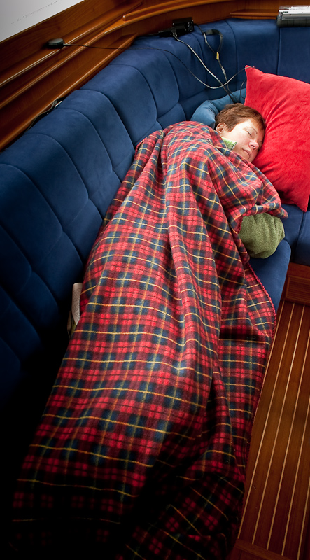
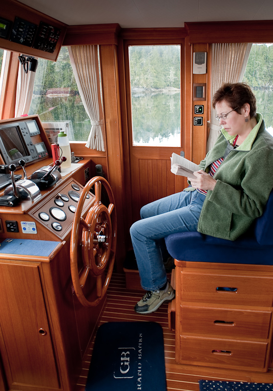
Given that our fair weather of the previous day had turned to rain, combined with the fact that we were both bone tired, made the day one of small projects around the boat, napping, reading, working on this blog and taking pictures between the raindrops. 20090907_Murray Labyrinth_0026 Karen Napping

20090907_Murray Labyrinth_0042

How Many Books Can Karen Read On a Rainy Day?

Although the forecast for tomorrow calls for a lot of rain, we still hope to get out and explore. Some of our most memorable trips in the kayaks and the dinghy have been in the rain, so we are seldom deterred by precipitation. Of course, a warm shower afterwards makes the memories even fonder. 

Right around 6PM the sun tried to make an appearance. Given the gloomy forecast for tomorrow, this is simply Mother Nature trying to tease us into optimism. For the rest of the evening it oscillated between rain, rain showers and more peeks of sun. Such is the weather in the Pacific Northwest.

20090907_Murray Labyrinth_0021-Edit

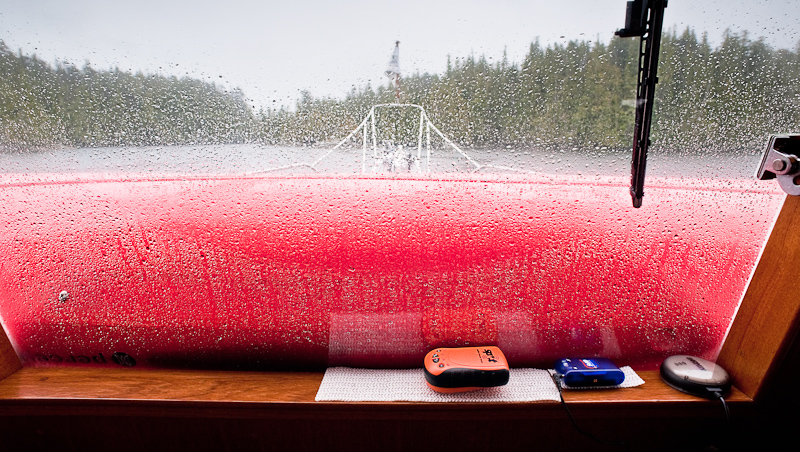
A Rainy Window Showing All our Satellite Gear: SPOT, Bluetooth GPS and XM Weather Receiver

The rain held off long enough for me to grill some sockeye salmon with an orange glaze accompanied by curried sweet potatoes.

Port McNeill to Miles Inlet

Despite our goal of an early departure, it was not until 9:29am that we cast off from the friendly docks at Port McNeill. Our host, Steve Jackman, runs a great facility. My praise is not based so much on the amenities, but on the “can do", “Do you need anything else” service that he and his staff offer. This year was noticeably different at the docks. Last year we were almost alone. This year the docks were full, and full of many large and magnificent boats. At 46 feet, our Grand Banks was definitely one of the smaller vessels tied to the docks. There was an “80ish foot”, to quote the captain, custom built motor vessel on up to a 130ft sail boat from shores afar. Steve said that he had spent the last year traveling to boat shows and other venues to “get the word out” and I think it worked. Bottom line; make a reservation, especially in season, to enjoy Port McNeill, “The Gateway to the Broughton Archipelago”, as the signs around town proclaim.

Here’s the link to The Port McNeil Fuel Dock and Marina

http://www.portmcneill.com/

The conditions on Queen Charlotte Strait were smooth seas with light winds, so we decided to combine two days into one and go direct to Miles Inlet rather than stopping first at Blunden Harbour. The total run was about 41nm. Queen Charlotte Strait, like all the large passages with a southeast/northwest orientation, can be nasty; “snotty” is the term yachties like to use, when the winds come up and work against the tide. It seems we were to be spared such conditions today. The clouds had split to the North and South, leaving us with a quiet window to make our crossing and then travel up the Strait. To the south, the clouds and wind brought heavy rain and lightening. Far to our north, the sky was dark and foreboding, filled with rain. Being in the middle of these two weather makers suited us fine. 20090906_Miles Inlet_0015-Edit

Calm Seas at Pulteney Point Lighthouse

20090906_Miles Inlet_0071 A Fellow Cruiser Enjoys A Calm Ride on Queen Charlotte Strait

Our reason to visit Miles Inlet was the expanse of quiet water that is only a short distance from Queen Charlotte Strait. Often in the Broughtons you have to travel many miles and negotiate a rapid or two to enjoy a place like Miles Inlet.

It’s location, just south of Cape Caution, makes this anchorage a popular place to bail out of Queen Charlotte Strait when heading north, and a hideaway to duck into when heading southbound after leaving Queen Charlotte Sound and passing Cape Caution.

20090906_Miles Inlet_0135-Edit Entering the Southwest Arm of Miles Inlet

20090906_Miles Inlet_0154-Edit

Arctic Star at Anchor in Miles Inlet

Miles Inlet’s other attraction is its usual double lagoons. At both the southeast and northwest arm of the “T” that is Miles Inlet you’ll find rather large tidal lagoons. The bodies of water that form behind a “bar” are always fascinating. As the tides cascade into or retreat from the lagoons, the resulting whitewater flows can be impressive. Most cruising guides suggest anchoring in the north arm or at the T (looking out at the Strait), but the tides were in our favor and we headed for the snug anchorage in the South Arm, right in front of the lagoon. It was serene and lovely. Not only were we visited by seals and an eagle, but a blue heron fished on the rocky shore just off our bow for at least an hour, entertaining us greatly. We were totally alone in Miles Inlet - just how we like it!

The North and South Lagoons of Miles Inlet

We did not leave enough time in the schedule to explore the inside of either lagoon, so next visit we'll correct that situation. It definitely looks like a great place to kayak.

20090906_Miles Inlet_0149-Edit

Outflow at the Southwest Lagoon

20090906_Miles Inlet_0164-Edit

Almost Slack at the Northwest Lagoon Entrance

Here is a link to another website featuring photos that show the bars and impressive flows of these lagoons.

http://bcmarina.com/Places/Miles_Inlet/Websize/thumbnails.html