Port McNeill to Miles Inlet

Despite our goal of an early departure, it was not until 9:29am that we cast off from the friendly docks at Port McNeill. Our host, Steve Jackman, runs a great facility. My praise is not based so much on the amenities, but on the “can do", “Do you need anything else” service that he and his staff offer. This year was noticeably different at the docks. Last year we were almost alone. This year the docks were full, and full of many large and magnificent boats. At 46 feet, our Grand Banks was definitely one of the smaller vessels tied to the docks. There was an “80ish foot”, to quote the captain, custom built motor vessel on up to a 130ft sail boat from shores afar. Steve said that he had spent the last year traveling to boat shows and other venues to “get the word out” and I think it worked. Bottom line; make a reservation, especially in season, to enjoy Port McNeill, “The Gateway to the Broughton Archipelago”, as the signs around town proclaim.

Here’s the link to The Port McNeil Fuel Dock and Marina

http://www.portmcneill.com/

The conditions on Queen Charlotte Strait were smooth seas with light winds, so we decided to combine two days into one and go direct to Miles Inlet rather than stopping first at Blunden Harbour. The total run was about 41nm. Queen Charlotte Strait, like all the large passages with a southeast/northwest orientation, can be nasty; “snotty” is the term yachties like to use, when the winds come up and work against the tide. It seems we were to be spared such conditions today. The clouds had split to the North and South, leaving us with a quiet window to make our crossing and then travel up the Strait. To the south, the clouds and wind brought heavy rain and lightening. Far to our north, the sky was dark and foreboding, filled with rain. Being in the middle of these two weather makers suited us fine. 20090906_Miles Inlet_0015-Edit

Calm Seas at Pulteney Point Lighthouse

20090906_Miles Inlet_0071 A Fellow Cruiser Enjoys A Calm Ride on Queen Charlotte Strait

Our reason to visit Miles Inlet was the expanse of quiet water that is only a short distance from Queen Charlotte Strait. Often in the Broughtons you have to travel many miles and negotiate a rapid or two to enjoy a place like Miles Inlet.

It’s location, just south of Cape Caution, makes this anchorage a popular place to bail out of Queen Charlotte Strait when heading north, and a hideaway to duck into when heading southbound after leaving Queen Charlotte Sound and passing Cape Caution.

20090906_Miles Inlet_0135-Edit Entering the Southwest Arm of Miles Inlet

20090906_Miles Inlet_0154-Edit

Arctic Star at Anchor in Miles Inlet

Miles Inlet’s other attraction is its usual double lagoons. At both the southeast and northwest arm of the “T” that is Miles Inlet you’ll find rather large tidal lagoons. The bodies of water that form behind a “bar” are always fascinating. As the tides cascade into or retreat from the lagoons, the resulting whitewater flows can be impressive. Most cruising guides suggest anchoring in the north arm or at the T (looking out at the Strait), but the tides were in our favor and we headed for the snug anchorage in the South Arm, right in front of the lagoon. It was serene and lovely. Not only were we visited by seals and an eagle, but a blue heron fished on the rocky shore just off our bow for at least an hour, entertaining us greatly. We were totally alone in Miles Inlet - just how we like it!

The North and South Lagoons of Miles Inlet

We did not leave enough time in the schedule to explore the inside of either lagoon, so next visit we'll correct that situation. It definitely looks like a great place to kayak.

20090906_Miles Inlet_0149-Edit

Outflow at the Southwest Lagoon

20090906_Miles Inlet_0164-Edit

Almost Slack at the Northwest Lagoon Entrance

Here is a link to another website featuring photos that show the bars and impressive flows of these lagoons.

http://bcmarina.com/Places/Miles_Inlet/Websize/thumbnails.html

Dusky Cove to Goat Island

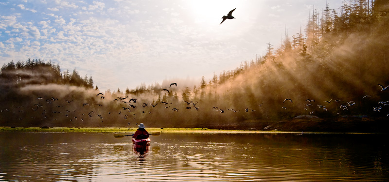
This morning was only half fog with the sun working hard to break through. I awoke early so we could launch the kayaks at low tide.  This is a great cove to explore when the water is low and the drying mud flats attract the gulls and other foraging birds for breakfast.

dusky_cove_karen_rem5930_print

Exploring the mud flats with the gulls

It’s always amazing to see dry land at low tide at the same place you came through at high tide in the dinghy. We paddled around the various islets that guard Dusky Cove exploring the drying shoreline. Crabs, a few sea stars, clams and a few small fish were the highlights of the shallow water. Our friends the seals never made an appearance, much to the disappointment of Karen.

_rem6005

Lots of islets to explore in and around Dusky Cove

_rem6043

Heading back to Arctic Star

Once all were secure again on Arctic Star, we listened to the whaleboats in order to find out what the Orcas were up to at Cracroft Point. Our plan is to go sightseeing for Orcas and Humpbacks and then determine where our anchorage is going to be for the night.

Our quest was realized as we found Humpback whales in Blackfish Sound first and then found ourselves surrounded by Orcas in Broughton Strait. The area in Blackfish was almost exactly the same location we had seen humpbacks the last two days. Same for the Orcas, they are mostly local pods, so they frequent the same areas every day, making the whale watching business a success in this area. All and all, we spent a couple of hours watching both species of whales.

_rem6122

_rem6230

_rem6157

_rem6205

_rem6143

Where you find whales, you'll find gulls...Lots of gulls

_rem6146

Modern whale watching boat

_rem6242

Classic whale watching boat

After all the communing with the marine life we pointed the bow of Arctic Star to Goat Island to enjoy a quite night in one of our favorite anchorages. Maybe we’ll spot the same bear we saw a few days ago!

Potts Lagoon to Goat Island

The alarm sounded its message at 6am, one hour before sunrise and a half hour before we wanted to weigh anchor. Our passage today would take us through Beware Passage. The information on this passage recommends low slack water as the ideal time to transition through this area. While it looks open, there are many islets and hidden rocks you must weave your way through.

Low tide affords the best possible look at the obstructions, although some never dry. We followed our plan and arrived at the start of Beware Passage right at seven. With an eye on the GPS plotter and another on the water, we had an uneventful passage. By taking it slow and following the recommended “low water” course to the north, it’s a fairly easy pass. The channel is deep, so all your attention can be directed to making good your course.

Shortly after transiting Beware Passage, we tucked into Native Anchorage on Village Island, a spot recommended by Max from Kwatsi Bay. Breakfast was on the agenda, followed by showers and a morning of doing nothing as we hoped for the skies to clear.

Except for a few dolphins that passed though the anchorage, we were alone. As has been the pattern for the last two days, the sun started to part the clouds about noon and we began to think about “where to next?”.

Our first stop was to look at the abandoned Indian settlement at Mamaliliculla. There was not much to see and we were not in the mood to make a dinghy assault on the beach and climb up to see the abandoned structures. We saw some from the boat, so we’ll save the on-shoring for another time.

Next we stopped (in the water) and looked at the Indian settlement at New Vancouver. The native Indians returned to this area in 2003 and built a very nice looking settlement with an outstanding dock and an impressive “big house”. We’ll add this to the “visit again” list to see if we can get a tour of the big house – it looks grand.

We continued a little further and dropped anchor in Mound Bay for a lunch stop. Mound was on our list as a possible overnight anchorage, but the locals gave it only an OK rating, so we decided to make this a brief layover. While having lunch, we heard on the radio that there were both Orca and Humpback whales in Blackfish Sound off Cracroft Point. As we were only 2.5 miles from there, we changed plans again and quickly made our way down Blackney Passage into Johnstone Strait. There were a few boats drifting in the area and sure enough, we saw whale spouts as we approached.

Once there, we took the engines into idle and drifted, watching and waiting. We were not disappointed. We saw numerous Orca whales. They were trying to feed on the white-sided dolphins that were there to feed on the smaller fish that congregate the confluence of Blackfish Sound and Johnstone Strait.

_rem4675

A medium sized female Orca swims by

_rem4688

Coming right at us

_rem4664

It's fun to see the different markings and to try to track specific individuals

_rem4682

Every fin is unique

When these two waters meet, large whirlpools and eddies form and the water churns and spins. As we watched the whales, our boat would spin gently in the whirlpool and bob in the turbulent waters. But that was a small price to pay for a good look at these mammals in action. We would see the dolphins moving along slowly and then suddenly they would accelerate, jump out of the water and swim for their lives with an Orca right on their tails.

After about an hour they moved on and so did we. Max from Kwatsi Bay had great things to say about the anchorage at Goat Island (off Crease Island), so we set course for his recommendation.

Max from Kwatsi Bay was correct. A beautiful panorama surrounds this special spot. As we settled in and after enjoying a beer on the flybridge, I went to the swim step to answer the call of Mother Nature. I was looking over at a nearby island and noticed a black rock. I was talking to myself about how we always hope that these black rocks are black bears, but we are always disappointed. Just then, the black rock moved.

“Bear!”, I called out to Karen, “come quick!” As it turned out, there was no need to hurry. The bear cooperated for the next hour as he went about his business. The funniest part of this experience is that there were a pair of very large ravens that were tormenting this bear.

_rem4795

Surround by noisy ravens

They would cry at him, fly mock attacks, even pick up a large piece of straw and threaten him. The two large black birds would surround him, one in the front and one behind.

_rem4786

What do you think the Raven on the right is going to do with that "stick"?

_rem4749

Air attack!

I’m not certain what the conflagration was all about, but after about 15 minutes, the bear got tired of these two, and moved on. He ate his way along the side of the island, enjoying a series of berry bushes and some hors d’oeuvres found by turning over rocks at the water’s edge.

_rem4832

The berry banquet

When he arrived at the end of the island, he proceeded to walk into the water and swim over to the next larger island.

_rem4881

Who you looking at?

_rem4905

Time for a change of venue

Once there, he continued his feasting on the berry buffet, until he disappeared in the thick forest. Watching him shake off the water like a large dog was really funny!

_rem4957

Shake it off

Needless to say, we had a great day – from now own, September 13th is officially known as “Critter Day.”

Kwatsi Bay to Potts Lagoon

Weather as predicted; as we awoke, we are greeted with low clouds and a fine mist. We are in no hurry; in fact, we spent a very lazy morning reading, working on the blog and doing a lot of nothing.  _rem4531editedit


The other boats starting leaving around 7:30 am with the last leaving just before we did; about 1 pm. We would have departed earlier, but Max wanted to chat. This is the first year that his family is gone for the winter so the kids can attend school in Port McNeill. The local school at Echo Bay was closed this year, forcing the kids and their mom to take up residence in the “big city” for the winter. Max has lots of projects on his list for winter at Kwatsi, but you can tell he is missing his loved ones. 

His loss is our gain because we were able to spend about an hour with him, listening to his stories and getting local knowledge on places to go, things to do and other destinations not worth the trouble. 

_rem4541


We’re as far Northeast as we planned to go. That leaves us with a three and half hour trip to make our way to the South Broughton Islands.

The weather was a repeat of yesterday, with the clouds clearing and the winds picking up in the early afternoon. The sun was welcomed for our spirits, but as we were traveling directly into the sun, spotting debris in the choppy water was a challenge. 

Karen made lunch in route and we shared duties at the helm because looking into the sun is very tiring.  

Right on schedule, we dropped anchor in Potts Lagoon. A nice sized lagoon tucked well off Clio Channel. There is a small community of float homes that call this lagoon home. The tidy little buildings sit on floating foundations that are tied to the shore. The largest of the buildings, and what appeared to be the oldest, was the site of much construction activity. It looks as if there was a recent addition made to the original building and the workers were busily running their saws and swinging their hammers. 

I started dinner early because we wanted to get to bed before 10pm. We are getting up at 6am tomorrow in order to make slack low water at Beware Passage. This small passage is a circuitous path around rocks, some visible, but most with their tops just below the water. It’s one of those many passages with a reputation that deserves respect. But with proper planning and careful navigation it can be traversed with safety.  

We’re going to take a look at the stars tonight, as the skies are clear. However, since we’re only three days from a full moon, the conditions are not ideal. Of course, not quite ideal here is a 1000 times better than back home with all the human light pollution. 


Waddington Bay to The Burdwood Group


Now here’s a change; we awoke to sunshine, not clouds, for the first time in three days. Admittedly it was a broken layer of clouds with Old Sol doing his best to peek though, but it was sunshine, nevertheless.

It is amazing how even this little bit of sunshine lifts the spirits. Our neighbors started getting underway shortly after 9am, a signal that they too were invigorated by the change in weather. The breaks in the clouds are being fueled by increased winds driven by a distant high pressure, and there are lots of high wind warnings in the nearby straits. Back among the islands where we are, the winds are fresh but not in the gale force category that plagues the more open waters.

Our plan is to visit The Burdwood Group of Islands. They are reputed to be a great location to Kayak, and having been boat- bound for the last three days, we are looking forward to getting out and exploring.

The Burdwood Group is known as a Kayaker’s heaven. As we would soon discover, its reputation is well deserved. From a boater’s perspective, the Burdwoods offer a challenge in finding a suitable spot to anchor. Most choose to only spend the day, with a picnic on one of the shell beaches being the main attraction. We were the only boat in the Burdwoods and, with the wind and water calm, we found a small anchorage between two islets in 30 feet.

It took two attempts, but we got a good set to the anchor, secured the “snubby” and dropped another 100 feet of rode on the bottom to make certain we held.

Next, the kayaks were placed in the water, and Karen put together lunch in anticipation of some pleasant paddle stroking this afternoon. We were not disappointed.

_rem3928edit_2 

Karen sets out to conquer the Burdwood Group

We weaved our way though the many small islands, interrupting the native critters as we went. In fact, when we came around one corner there were a couple of dozen seals on the beach that, when they saw Karen appear, took to the water with a great sound and flurry. They followed us for a while until we left their homestead.

A new bird was spotted, a Barrow’s Goldeneye. As we approached, mom led her chicks into the water and around behind a small outcropping of rock while dad stood guard. Finally, when the family was safe behind the rocks, he jumped into the water and joined them.

When we anchored, we were in sight of one of the two largest white shell beaches in the Group. The other is, in fact, a mirror image and lies just on the other side of the beach we could see from the boat. As we paddled back towards our boat, we stopped on that other beach and got out to set foot on firm land for the first time in about 6 days.

_rem3952edit_2

The Kayaks on "dry land" for the first time

_rem3955_2

Maybe this is where they got the idea for the infinity pool

_rem3957_2

Arctic Star nestled in the Burdwood Group

Just above the beach was a great Kayaker’s campsite, complete with fire pits, log “furniture” including what Karen called a breakfast bar (I simply stated that it was “The Bar”). It was easy to imagine a few Kayakers standing around in the evening sunset, beers in hand, telling tales of their adventures that day.

_rem3944_2

Can't you see a group of Kayakers gathered around this "rustic bar"

Our day ended as we watched a large seal frolic right off the boat’s bow, breaching and tail splashing like mad.

_rem3991edit_2

Karen stops in front of Arctic Star before we call it a day

Driftwood_mid_dark_light_2

The driftwood is always full of interesting patterns